By Jeff Winslow
Photos from the Story of Big Creek by Dave Redinger
The weather around Mono Hot Springs, Northern California’s most remote hot springs resort can come in all different forms during the summer in the high sierras – and sometimes in very intense cloud bursts! I remember one summer that it actually flooded the store and cabins at the resort, and we’ve had maybe two or three of those in the 55 years I’ve been up here.
One particularly scary incident occurred when I was delivering mail to the Huntington Lake Post Office for Mono Hot Springs and an unusually intense thunderstorm hit just as I was coming over 9184 foot Kaiser Pass. The cloud burst was so extreme I couldn’t see anything in front of me. I had just passed the crest and was beginning the decent about 200 yards south of the summit when I reached what was normally a small creek that usually ran through a culvert under the road that was now running over the road with about a foot of water. The culvert wasn’t able to take all the water and was running right over the top of the road off this very steep mountain side.
I just sat there for a while until the rain had subsided a bit and decided I better try to make it across while I still could. Getting across this patch of road was worrisome because the swiftness of the water could take my truck right off the road, but I made it through! Then, as I looked in my rear view mirror, to my astonishment I saw the whole road slide down the mountain side leaving about 25 foot gully behind me!
So, that was a moment I felt really lucky to be alive because I could have very easily lost my life on that ordeal!
It probably took the forest service about two days to fix the 25 foot gap in Kaiser Pass Road so we had all the people in Moto Hot Springs stranded except for a long alternate route on the Stump Springs Road.
Over the 55 years I have been running the Mono Hot Springs Resort, I have probably driven Kaiser Pass longer and more often than anyone. I’ve seen a lot of things on the Kaiser Pass road during this time, including having a couple bears and a few deer run out in front of me.
A few years ago my son Joe, while driving on the Kaiser Pass Road, had a bear run out in front of his pickup truck and hit it with his front bumper that sent the bear ass over tea kettle down an embankment, but apparently not seriously hurt, the bear, mad as hell at the pickup, shook off being hit, and charged up at the pickup, growling and snarling really loud and then just before getting to the pickup, Joe honked the horn and revved up his diesel engine stopping the bear at the pickup, so, Joe then speedily drove off. He remembers looking into the angry bear’s eyes that said, you better get out of here because I ‘am really mad as hell. Needless to say, it was quite an eventful day for Joe.
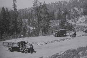
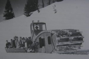
At the very top of Kaiser Pass are parking areas, toilets, and a plaque commemorating Alaskan Jerry Dryer’s dog sled team, Whiskey, Babe and Trim that are buried there at the summit. The dog sled team delivered mail to the Edison Company workers through the winters during the Big Creek Project for about for five years during the 1920s. The Kaiser Pass road was built in the early 1920’s as part of the huge hydroelectric project known as the “Big Creek project” .A little bit about the Big Creek Project:
Initially, in the early 1900’s the Southern California Edison Company first conceived of the” Big Creek Project” and by 1916 they had water flowing out of Huntington Lake down to the Big Creek electrical generating plants, but the full potential of the electricity generating water resource was in the high country. The ultimate goal was to capture water from the other higher areas of the San Joaquin drainage by building Florence Lake and capturing Mono Creek by a Diversion Dam and running it through a tunnel to Huntington Lake. This high country project was commenced with the building the Kaiser Pass Road in the 1921 with the subsequent construction of the Ward Tunnel bored straight through the mountain from Florence Lake Dam to Huntington Lake that was completed 1927.
There’s a very nice side trip you can take from the top of Kaiser Pass that’s about 2 miles or 10 minute drive that leads to a spectacular overlook on a dirt road that any two wheel drive car can handle. It’s the road at the very crest of Kaiser Pass that heads out east to Mount Givens that takes you up to a 10,000 feet. There’s a balancing rock you can walk out on with a thousand foot drop! You have a sweeping view of Yosemite’s back county, the minarets, Mono Hot Springs, Edison Lake and the high Sierra Nevada back county peaks that are 10,000, 11,000 and 12,000 feet all around you.
We sometimes see nice deer around the top of the pass in the meadows just north of the top of the pass. Some seasons you’ll see a lot of deer in those meadows – lovely bucks! Other seasons hardly any. Kind of funny how deer move around and change their pattern where they go, some season you see lots of them other times barely see one. They’re someplace else!
At 2 miles or about a six minute drive north down from the top of Kaiser Pass is a turn off to the west on Sample Meadows Road that takes you down to just above Mammoth Pools and ends up just above Big Creek. It’s also a scenic road with you dropping down in elevation to about the 5,000 foot level. At one stretch of the road, you are looking down on Mammoth pools at the 3,000 foot level. This road takes about another extra hour but that’s another way you can go out to Shaver Lake.
As you make your decent winding through the meadows and woods, about 4.6 miles past the summit or 14 minutes of drive time, you suddenly come to the opening of a very dramatic expansive view stretching from the backside of Yosemite – that’s about 30 miles as the crow flies – all the way up through the Minarets Area and the beautiful white granite mountains known as the Range of Light in the Ansel Adams and John Muir Wildernesses.
7 miles or about 24 mins driving time from the top of Kaiser Pass you come to the Portal Forebay which is a small 20 acre lake at 7,180 feet that serves as a holding forebay for the Portal Power House located on the other side of the pass at Huntington Lake.
Being a relatively small lake with a trail around shore, fishermen find this a good place for fishing from a canoe or float tube with the waters stocked with Rainbow Trout and Eastern Brook. The limit is five per day, ten in possession.
There is a campground on the lake with 11 campsites available on a first comes-first serve basis. No drinking water is available at this campground or the nearby Camp Sixty One to the west of the lake on the road in.
As you continue to drop and round the corner from the Portal Forebay, Kaiser Pass Road goes through one of its most scenic passages where the road is chiseled into steep granite vertical cliffs with stunning views of the Range of Light that keep opening to the east up the basin as you continue ascending to the headwaters of the South Fork of the San Joaquin River.
A couple miles past the Forebay you come to Bosillo Campground, the High Sierra Ranger Station and the trailhead to Corbett Lake. The campground has three campsites that run adjacent to the creek with the trailhead to Corbett Lake beginning at the end of the campground. This camp has potable water.
Corbett Lake is a three mile hike from 7,400 ft trailhead to the lake at 9,070 ft. About one mile into the hike through beautiful old growth forests you hit 19 switchbacks in a particularly steep 800 foot climb. The views that are opening up of Devil’s Tower, Lake Edison, Devil’s Bathtub and Mary’s Mountain behind the Mono Hot Springs resort makes the climb worth it! The lake itself has excellent Trout fishing, and for the hearty, about another three quarters of a mile higher on the trail through stunning high sierra ice sculpted granite is Givens Lake.
You can stop at the High Sierra Ranger Station and find out any passes or permits you may need to enter the backcountry.
As you continue to descend past the Ranger Station, the road opens just before you reach the turnoff to Florence Lake, and you will notice a door on your right that’s the entrance to a tunnel bored into the solid granite.
You then come to a fork in the road, with another 6.4 Miles drive to Florence Lake, or take the left on Edison Lake Road down what is becoming the steepest part of the drive to Mono Hot Springs.
Running along the side of the road is the giant siphon pipe covered with rocks which connect the waters of Edison Lake and Bear Creek Diversion Dam to the tunnel that runs through the mountain to Huntington Lake on the other side of Kaiser Pass.
Just past where some beautiful meadows open on the left you will come to a place you can park on the right that has a lot of exposed tree roots and just above the road here you will find a delightful small hot spring. Across the road and just below this where the road makes a right turn and crosses a grated bridge there is an overlook that looks down on one of Mono Hot Springs treasures – Little Eden.
This pool that’s big enough to swim in is found in a spot that defies logic, right at the top of a ridge with beautiful views that stretch to Yosemite. From the overlook where you can see the Mono Hot Springs Resort below across the river, Devils Table is the flat toped black outcrop to your left and Mary Mountain standing over the resort to your right, you can find the foot trail down to little Eden by going around either side of the boulder you are standing on, but to the left is easier.
After you cross the metal grating bridge which crosses the siphon you can see running across the river and up the other side of the valley to Lake Edison, the road gets steeper, and steeper and steeper! This is definitely not a road you want to be on on an icy morning before this north slope sees the sun!
When you come to the bridge over the South Fork of the San Joaquin, you will notice a parking area to the left of the road. Here is the foot trail you can take to the Hot Springs which line the south side of the river.
As you cross the bridge, note the Siphon Pipe which also crosses the river. Although this is the lowest point the water flows through the Siphon crossing the river, the water pressure from its head at the Bear Diversion Dam pushes the water right up the hill you just came down to go through the tunnel in the mountain.
You will see the turnoff to Mono Hot Springs Resort just past the bridge.
If you get out of your car at this point to take in the full expanse of the view and listen, note what a deafening silence you’ve come into were all the background noise from the rest of California is shielded behind the ridge to the west and you’ve entered into an entirely new realm of soul soothing silence! It’s one of the most scenic roads you will ever see anywhere and the views from here are absolutely spectacular!
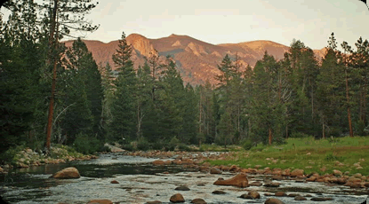
The Range of Light visible to the North is from the Minarets Area all the way up to Florence Lake and into Kings Canyon National Park. It’s characterized by unusually light colored granite that gives it such a unique character with unbelievably huge boulders everywhere that makes it some of the most beautiful parts of Northern California’s Sierra Nevada.
Yes, some people think the road is a bit scary because it’s a little rough, narrow and bumpy in some places and for short distances there are cliffs. For others, this is exactly what they love about this road the most! The Kaiser Pass Road is the most remote you can get in the Sierra Nevada by car. Because this road does not cross the Sierra Nevada like in Yosemite or Sequoia, you find peace instead of crowds.
After 55 years of driving the Kaiser Pass Road probably more than anyone, I’ve only twice had a light fender bender. I tell people you have to be awake, but it’s the safest 12 miles in the world. There have been a few fender benders but no fatal accidents or anyone ever even hurt because you certainly can’t go very fast on this road!


Leave a Reply
You must be logged in to post a comment.